Database system for Palaeontologists and Biologists
|
|
PaleoTax Database system for Palaeontologists and Biologists |
| Home | Download | Information | F.A.Q. 2.0 (German) | Tour (2.1) | User | What's new ?
| F.A.Q. 2.x | (English) PaleoTax/ | Map Version 2.5
| |
PaleoTax/Map comes in version 2.2.3 with the same vector data set as in CP Map 1.x, so user of CP Map 1.x may use the same detailed data set. PaleoTax/Map allows to display the GTOPO30 data (topographical data in a 30-second-raster, free available from the Internet). The data can be downloaded by the user, but must be converted before using with PaleoTax/Map, or can be ordered on a pack of 3 CD-R or DVD.
Locality data can be directly displayed within PaleoTax, or exported to PaleoTax/Map. Maps can be exported in the WMF/BMP format. The new versions allows also the import of NIMA data (which are quite coarse). It is also possible, to record manually point, lines and polygons, and to save them as ASCII files (which can be read by Paleotax/Map). Manually recorded data can be modified in PaleoTax/Map.
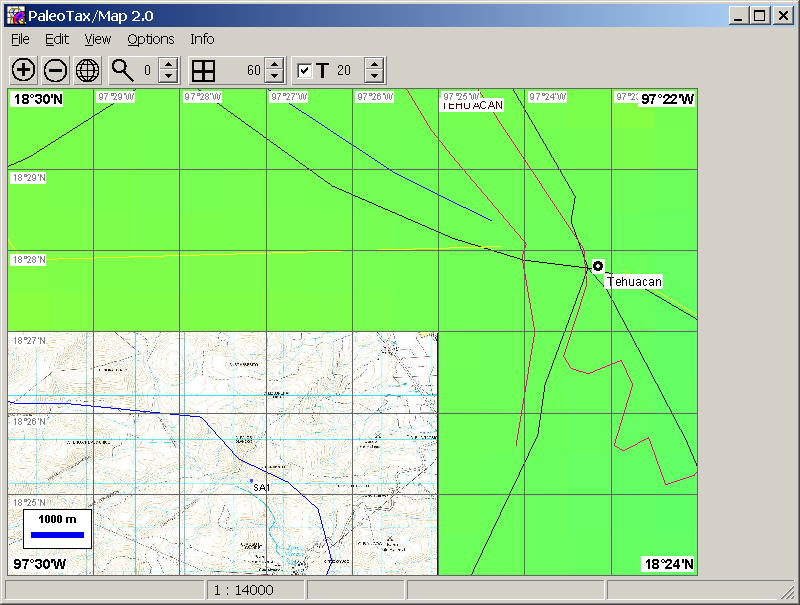
Scans of topographic or geologic maps can be loaded as a background bitmap (Example).
Please note: there is a documentation on version 2.2.3 (see documentation for download).
Functionality:
This programme version was released in May 2023. The Internet version will have only a small amount of data; the full set by request on CD-R. PaleoTax/Map is available in English, German, and Spanish.
See examples below !
© Hannes Löser, Hermosillo, Sonora, Mexico.
PaleoTax/Map is a small G.I.S. to plot locality and occurrence data of PaleoTax in a (today!) map. It is with a basic data set of coastlines and borderlines, and a basic topographic data set (1 degree raster). More detailed data (vector data with a precision of 200m, topographic data in a 5 minute raster) by request on CD-R. The detailed data set encompasses various geographic, political and population data.
Look, how it does work within PaleoTax.

Enlarge - Reduce - Whole World - More/less details -More/less raster - Topo data, more / less detailed - Close vector or polygon - Move point
Open file (PTM, TXT, BGM)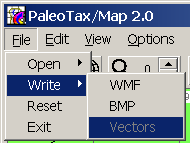
Write file (as WMF, BMP, JPG, or vectors) - Reset - Quit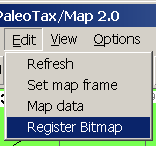
Refresh map - Select area manually - Edit map data - Register Background Map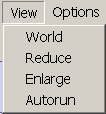
Whole world - Reduce - Enlarge - Start demo


Topographic map (without grid, coastlines, rivers etc.). Click on the map to see an enlarged image and more examples.
World map. Click on the image to enlarge step by step.
Updated : 04-30-2023.